• Smart City
  • Location Intelligence
  • Infrastructures
  • Öffentliche Sicherheit
  • Smart Environment
  • GeoAI
  • Smart City
  • Location Intelligence
  • Infrastructures
  • Öffentliche Sicherheit
  • Smart Environment
  • GeoAI
Themen
3D Augmented Reality Big Data BIM Breitbandausbau Bürgerbeteiligung Case Study Covid-19 Dashboard Digital Twin DigitalTwin Health Screening Imagery Indoor Navigation IoT Kartografie Klimawandel KRITIS Lagebild Last Mile Delivery Machine Learning Mobilität Monitoring Nachhaltigkeit Open Data Operational Intelligence Realtime Analytics Stadtplanung Standortanalyse Startups Supply Chain Tourenplanung Umweltmonitoring
Facebook
Twitter
Instagram
YouTube
LinkedIn
RSS
  • Location Intelligence
  • Smart Environment
  • Smart City
  • Infrastructures
  • GeoAI
Abonnieren
  • Location Intelligence

Expansion and Risk Management: Swarovski and Migros are Now Relying on Geodata

  • 3 minute read
  • Roland Schenkel
0
0
0
0

Companies like Migros and Swarovski are using geodata to make their businesses more successful. Experience shows that those with knowledge of spatial context make better decisions.

The Swiss retail company Migros and the jewelry and accessories manufacturer Swarovski have long since come to appreciate the value that knowledge of the spatial context offers. For quite some time now, both companies have been making use of GIS-based analyses, in particular to support their expansion planning, risk management, and supply chain optimization activities.

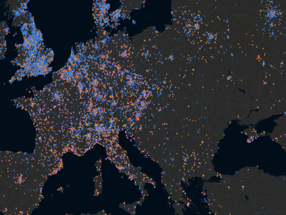
Swarovski is expanding its market presence around the globe

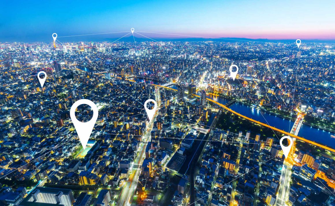
GIS can be used to identify the ideal location for a new store, for example. To this end, data on demographics, income structure, travel times, and competitors is collected and linked, after which the best location for investment is shown on a digital map.

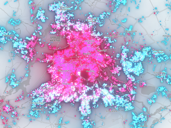
As Global Distribution Operations Manager at Daniel Swarovski Corporation AG, Richard Bezuidenhout is responsible for developing Swarovski’s company-wide Geospatial Platform, which is employed as a support tool for increasing the sale of jewelry and accessories around the world. Here, dashboards created and hosted on the Esri platform are used by Swarovski to provide important decision-making information to those who need it.

Richard Bezuidenhout, Global Distribution Operations Manager at Daniel Swarovski Corporation AG

For example, store locations in various sales regions can be displayed on digital maps along with the associated KPIs, the locations of competitors, social-demographic data, and market data. These maps are supplemented by statistical diagrams and then made available for viewing in the browser-based dashboards.

Through its implementation of a location intelligence strategy, Swarovski is now able to combine spatial and business data and draw conclusions that make its business more successful. The dashboards are used to evaluate existing and potential future store locations, and for marketing planning purposes as well.


WEBINAR-RECORDING:
Successful Market Development with Location Intelligence
In the webinar, our experts will show how companies facing the challenges of a dynamic market.

Migros: Green supply chain and digital risk management

The Migros supply chain extends across the entire globe. In order to maintain a clear overview of this supply chain and be able to react quickly and in a customer-focused manner to unexpected incidents, the Swiss retailer has developed a central system for real-time supply-chain monitoring known as the LTOPEX Tower.

The system displays maps that employees use to monitor the supply chain, whereby deviations or delays are clearly shown on the maps as they occur over the course of time. The system thus makes it easier to implement targeted quality assurance measures that improve supply chain operations.

“The LTOPEX Tower is a central intelligent platform that enables the efficient planning and management of all transport services and ensures complete process transparency and effective monitoring and control,” says Thomas Wunderli, Head of Business Processes and Systems at Migros Logistics and Transport.

According to Wunderli, successful anticipatory risk management requires digitalization and an understanding that risk also always includes a spatial element: GIS technology covers both of these requirements.

Video-Interview: Thomas Wunderli, Head of Business Processes and Systems at Migros Logistics and Transport

Another issue facing numerous companies today is how to reconcile global business growth with sustainable business operations. Migros is well aware of its responsibility as a corporate citizen, which is why one of its goals is to establish a low-carbon supply chain. Esri technology is playing an important role here as well, since the data collected by Esri systems helps make it possible to create speed and road gradient profiles for truck routes. This in turn makes it possible to not only plan the most energy-efficient routes but to also choose the best drive system (biogas, hydrogen, electric, or diesel) and thus optimize decarbonization measures for entire vehicle fleets.

It’s important to employ a holistic approach here, as alternative fuels have to be produced in a sustainable manner and leading technology and research partners need to be involved in the implementation of all measures.

More: 

Webinar-Aufzeichnung: Erfolgreiche Marktentwicklung mit Location Intelligence 

Interview mit Location -Intelligence-Experte Philipp Marty: «Unternehmen dürfen den Anschluss nicht verlieren.» 

Share
Tweet
Share
Share
Share
Related Topics
  • Realtime Analytics
  • Standortanalyse
  • Supply Chain
Voriger Artikel
  • Location Intelligence

Location Intelligence und Esri: Ein Gespräch über die Zukunft

  • Wolfgang Emmer
Weiterlesen
Nächster Artikel
  • Smart Environment

Podcast: Dank transformativer Technologie mehr Nachhaltigkeit

  • WhereNext Redaktion
Weiterlesen
Auch interessant
Weiterlesen
  • Location Intelligence

Mit ArcGIS Immobilienmärkte besser verstehen – Einblicke in die strategische Nutzung von Geodaten  

  • Andreas Kunert
  • 30. April 2025
Weiterlesen
  • Location Intelligence

Esri Konferenz 2024: The Power of Where

  • WhereNext Redaktion
  • 2. Dezember 2024
Weiterlesen
  • Location Intelligence

Digitalisierungssprung in Bayern: ArcGIS Pro Virtualisierung optimiert Staatsbauverwaltung

  • WhereNext Redaktion
  • 20. März 2024
Weiterlesen
  • Location Intelligence

Der Digitale Projektzwilling revolutioniert die Dorsch Gruppe

  • WhereNext Redaktion
  • 20. März 2024
Zug im Hauptbahnhof Frankfurt am Main in Deutschland
Weiterlesen
  • Infrastructures
  • Location Intelligence

Wie das Venture TracE die Digitalisierung bei der Deutschen Bahn mit GIS und Location Services vorantreibt

  • WhereNext Redaktion
  • 26. Januar 2024
Weiterlesen
  • Location Intelligence

Unterstützung von Kriseneinsätzen und Großübungen von Hilfsorganisationen mit Geo- und Fernerkundungsdaten

  • WhereNext Redaktion
  • 9. Dezember 2023
Jürgen Schomakers eröffnet die Esri Konferenz 2023 in Bonn
Weiterlesen
  • Location Intelligence

Esri Konferenz 2023: Zwei Tage GIS und Digital Twins

  • WhereNext Redaktion
  • 30. November 2023
Weiterlesen
  • Location Intelligence

Location Intelligence: Büroflächen nach der Pandemie neu gestalten

  • WhereNext Redaktion
  • 7. August 2023
Roland Schenkel
berät Unternehmen zu den Tech-Themen Risk Management & Digital Supply Chain.
  • Digitale Nähe schaffen: Wie eine mobile App Kommunen und Bürger verbindet

    Weiterlesen
  • Wald Borkenkäfer

    GIS im Kampf gegen Waldschädlinge

    Weiterlesen
  • Starkregenvorsorge: Wie sich die Stadt Göttingen vor Unwetter schützt

    Weiterlesen
WHERENEXT

Das Fachmagazin für Best Practices, Interviews und Success Stories rund um Location Intelligence.

Herausgegeben von Esri Deutschland und Esri Schweiz – den Anbietern für Geospatial Infrastructure.

MEISTGELESEN
  • Vom Tropenwald nach Amsterdam: Wie GIS die Reise von FSC-zertifiziertem Holz sichtbar macht 
  • Mit ArcGIS Immobilienmärkte besser verstehen – Einblicke in die strategische Nutzung von Geodaten  
  • Titelbild
    Karlsruhe auf dem Weg zur Sensor City: Wie ArcGIS die Stadt klimafit macht 
INFO
  • About
  • Impressum
  • Datenschutzerklärung
  • Esri Deutschland
  • Esri Schweiz
  • ArcGIS

Gib dein Suchwort ein und drücke Enter.

X